This assignment was a team project
consisting of 10 members of which I was Team Leader. My responsibilities consisted
of proper time management, daily reviews of progress with the team from the firm Design Workshop, major decision-making,
as well as overall aiding in design and final presentation development.
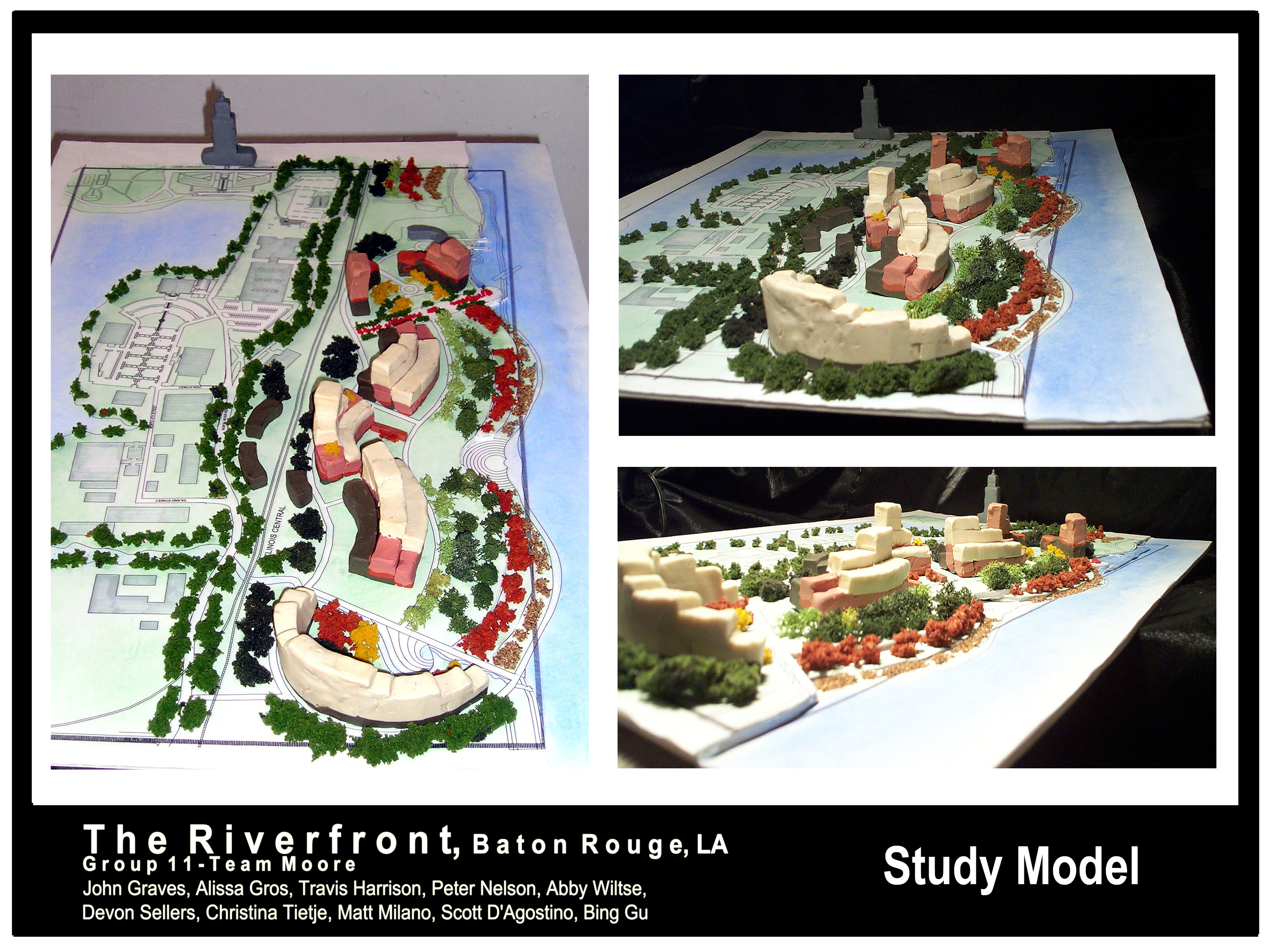
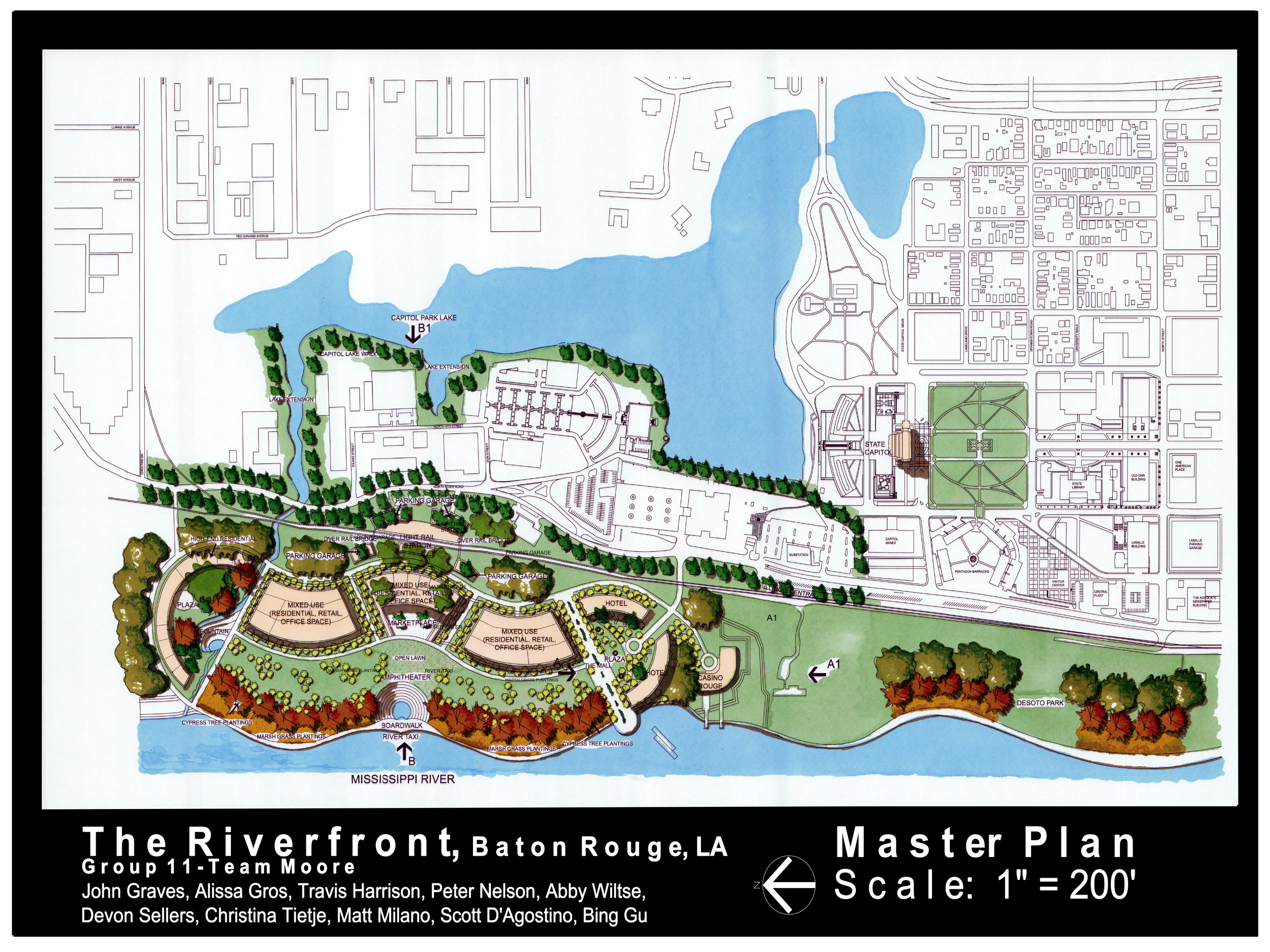
Concept: This was conceived through the study of layers.
We initially looked at geological layering, specifically at sedimentary rocks due to the obvious relationship the site
has with the Mississippi River. We allowed this idea, along with the free-flowing
path of the river itself, to guide our forms.
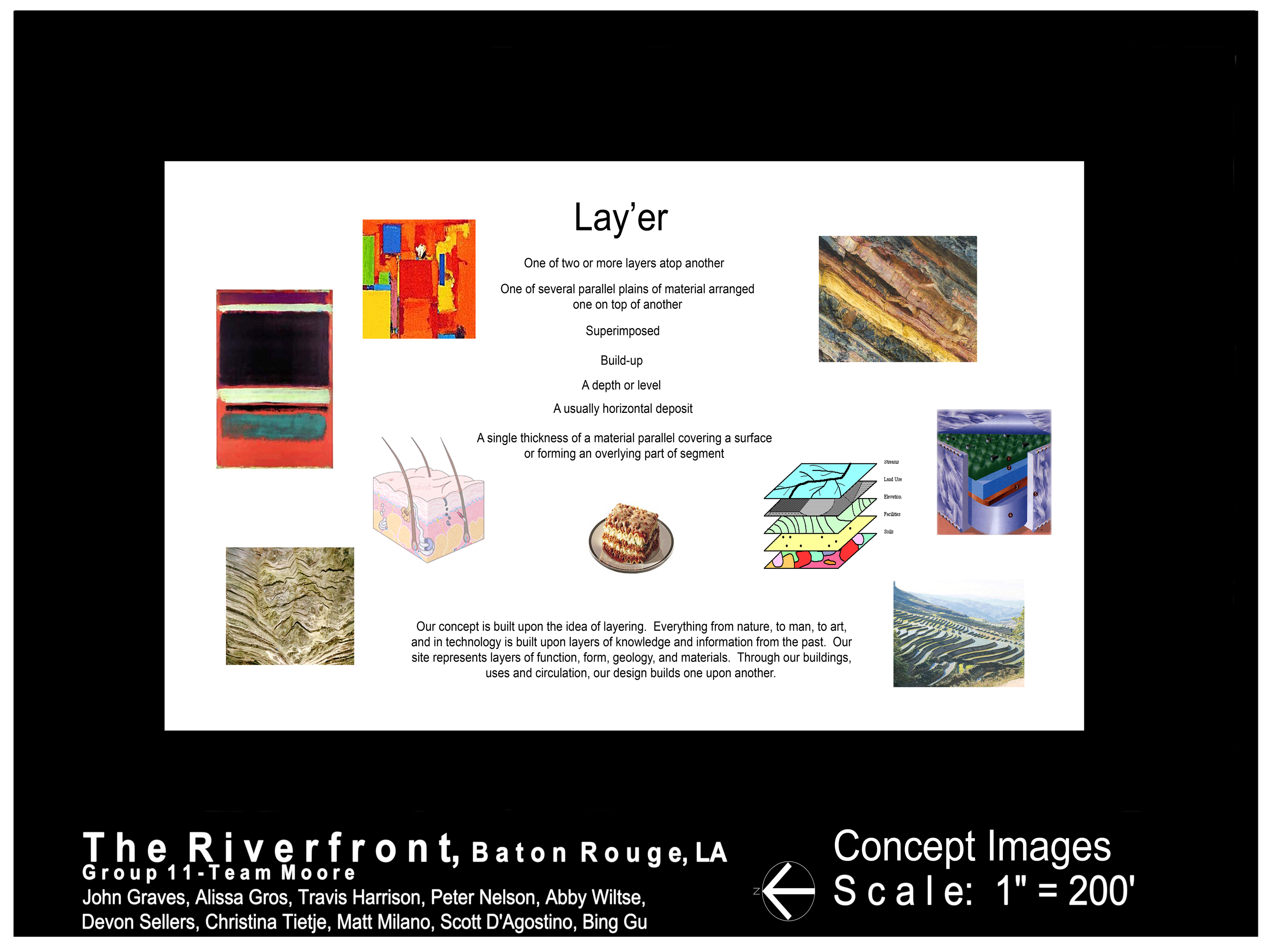
We then looked deeper into
layers in all forms, trying to really grasp the essence of the concept we had chosen.
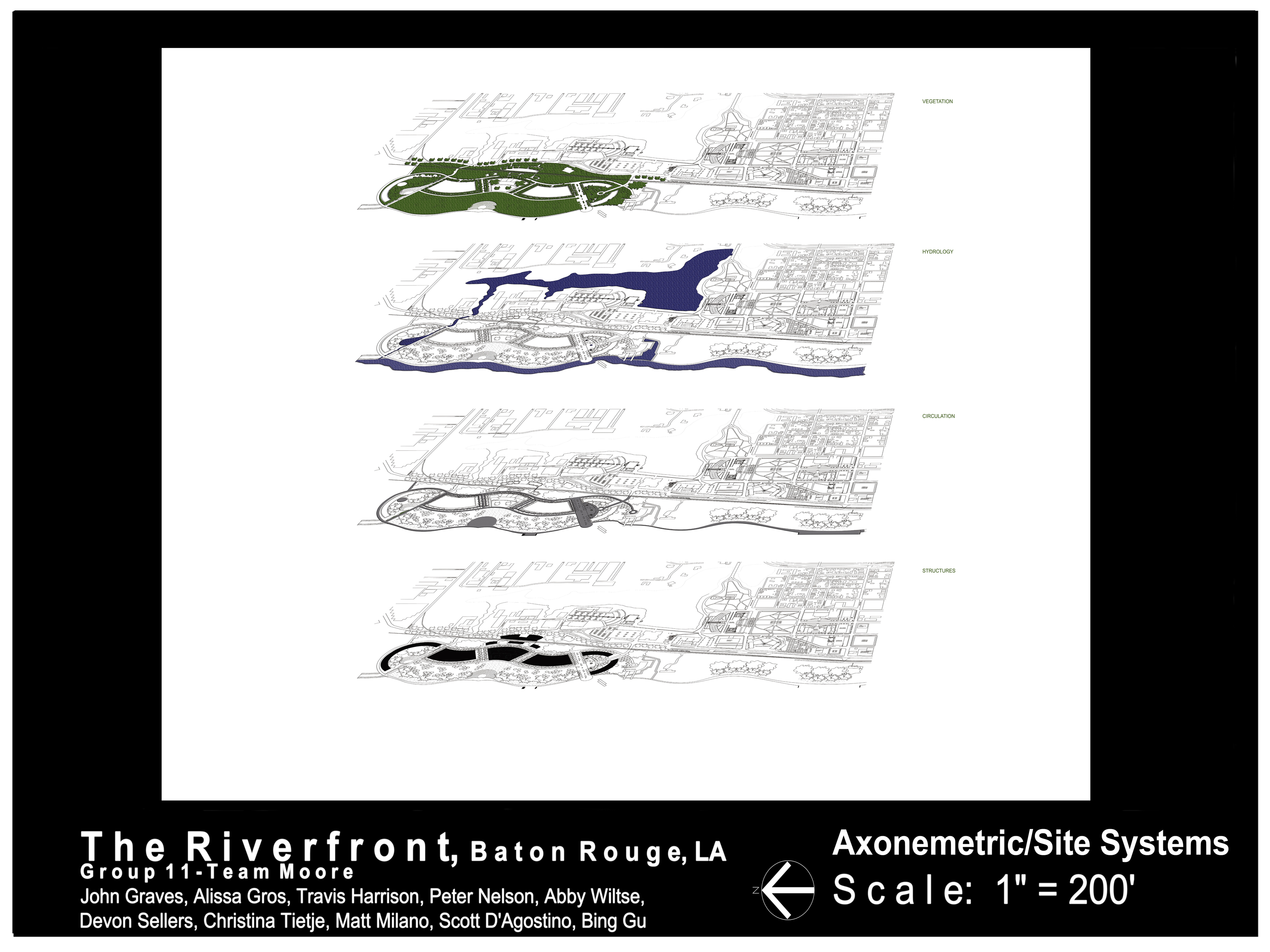
Soon we realized that layering went beyond just physical forms and could be applied to any number of aspects of the
design including, but not limited to, vegetation, hydrology, vehicular and pedestrian circulation, and structures.
Soon our design came to represent
layers of function as well as form, with both overlying and superimposed upon one another numerous times over.
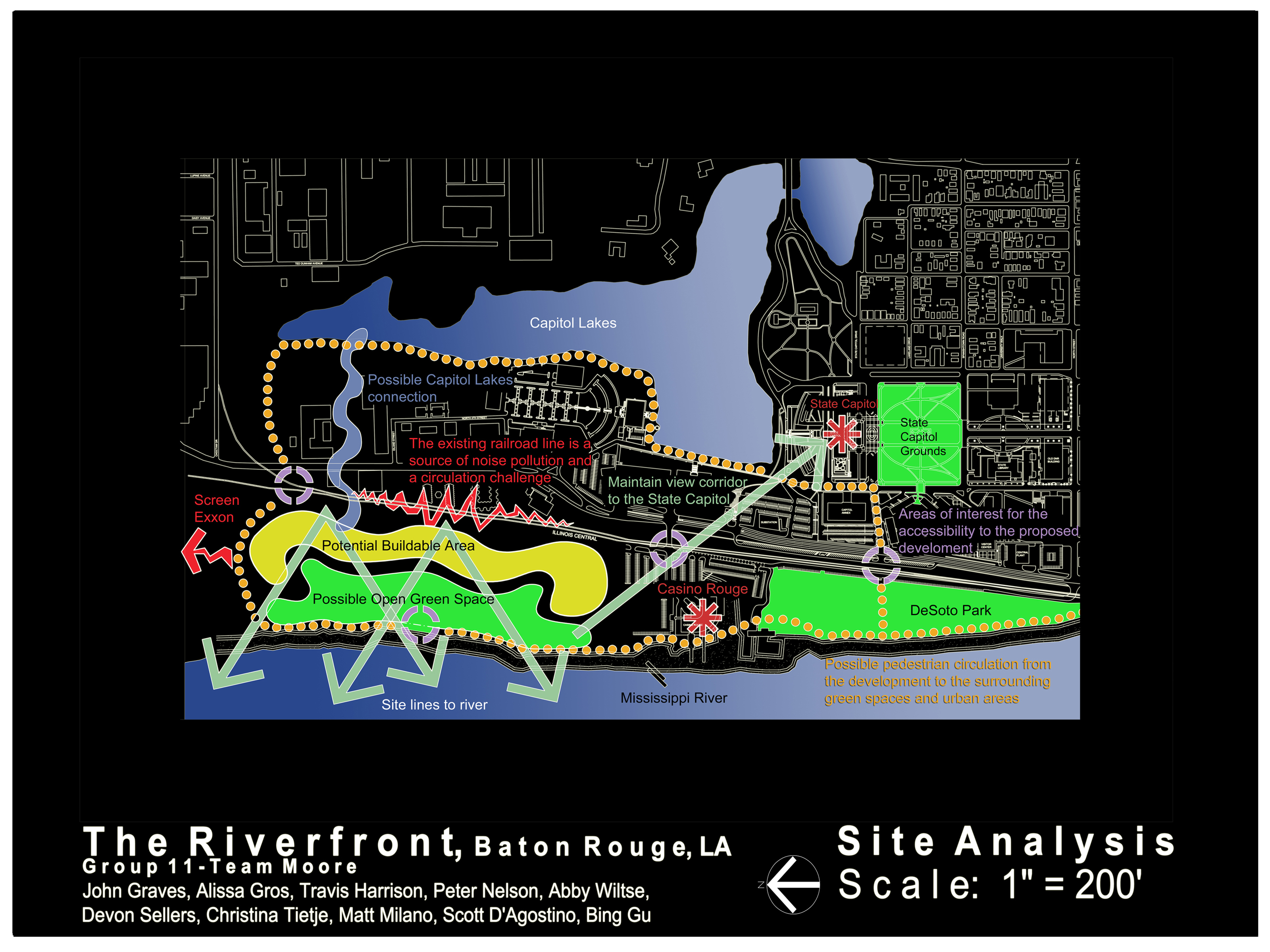
We then looked at the site itself. Our site analysis showed the following key points:
·
There is a potential noise and visual problem coming from the north towards Exxon as well as to the east from
the railroad.
·
There are four very nice opportunities for vistas from the site to the river and a chance to visually tie the
site to the State Capitol.
·
There exists an opportunity to physically connect our site to the Capitol Lakes, which in turn would connect
to the State Capitol Grounds, that would then connect to DeSoto Park.
·
We felt the north, south, and eastern-most parts of the site would be best for building sites and the western-most
part (facing the river) most suitable for open space.
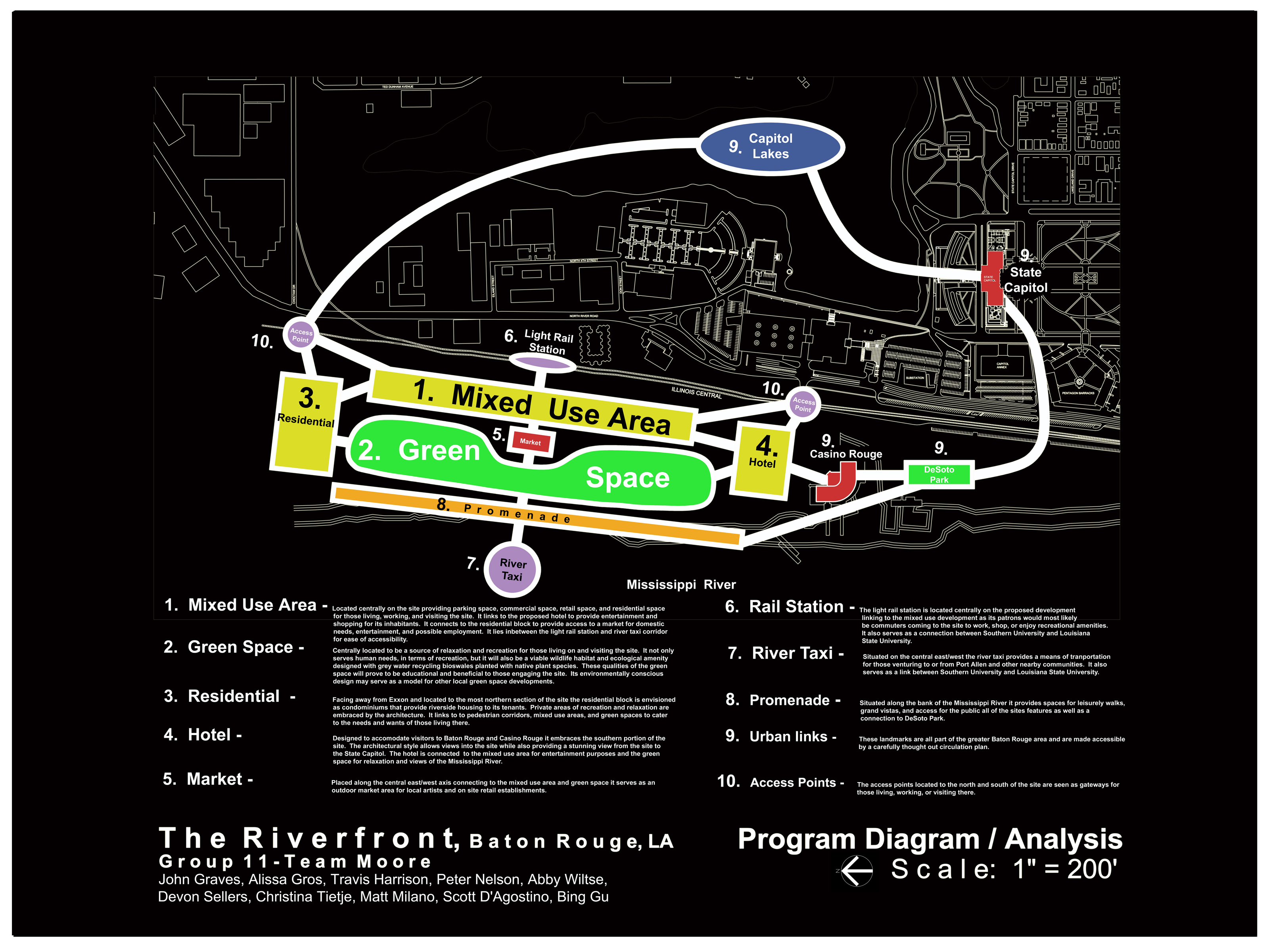
We located a variety of elements within
our design through our program analysis.
The mixed-use area
was centrally located on the site providing parking, commercial, and retail spaces, as well as residential units for those
living working and visiting the site. The area would be:
- Linked to the proposed hotel to provide entertainment and shopping for its inhabitants.
- Connected to the residential block to provide access to a market for domestic needs, entertainment, and possible employment.
- Located between the light rail station and river taxi corridor for ease of accessibility.
The green space was also centrally located as it was meant to be a source
of relaxation and recreation for those living on and visiting the site. It would
not only serve human needs in terms of recreation, but would also double for a viable wildlife habitat and ecological amenity
design with gray water recycling bio-swales planted with native plant species. We
felt these qualities of the green space would in especially prove to be both educational and beneficial to those engaging
the site. In addition, its environmentally conscious design would serve as a
model for other local green space developments.
The residential units
were located facing away from Exxon and to the northern-most section of the site. The
residential block is envisioned as condominiums that provide riverside housing to its tenants.
Private areas of recreation and relaxation would be embraced by the architecture.
This building would link to pedestrian corridors, a mixed-use area, and green spaces to cater to the needs and wants
of the inhabitants.
The hotel was designed
to accommodate visitors to the city of Baton Rouge as well as Casino Rouge. It
would embrace the southern-most portion of the site. An architectural element
would allow views into the site while also providing a stunning view from the site to the State Capitol. The hotel would be connected to the mixed-use area for entertainment purposes in addition to the green
space for relaxation and views of the Mississippi River.
The market was placed
along the central east/west axis connecting to the mixed-use are and green space. It
would serve as an outdoor market area for local artists and on-site retail establishments.
The light rail station
was located centrally on the proposed development linking to the mixed-use area, as its patrons would most likely be commuters
coming to the site to work, shop, and/or enjoy recreational amenities. It would
also serve as a connection between Southern University and Louisiana State University.
The promenade is situated
along the bank of the Mississippi River. It would provide spaces for leisurely
walk, grand vistas, and access for the public to all of the designs features as well as a strong connection to De Soto Park.
The urban links
are all landmarks that are part of the Greater Baton Rouge area and are made accessible by a carefully thought-out circulation
plan. The access points are located to the north and south of the site
and are seen as gateways for those living, working, and visiting there.
 Click on above picture to enlarge.

|